


Monday 3 July
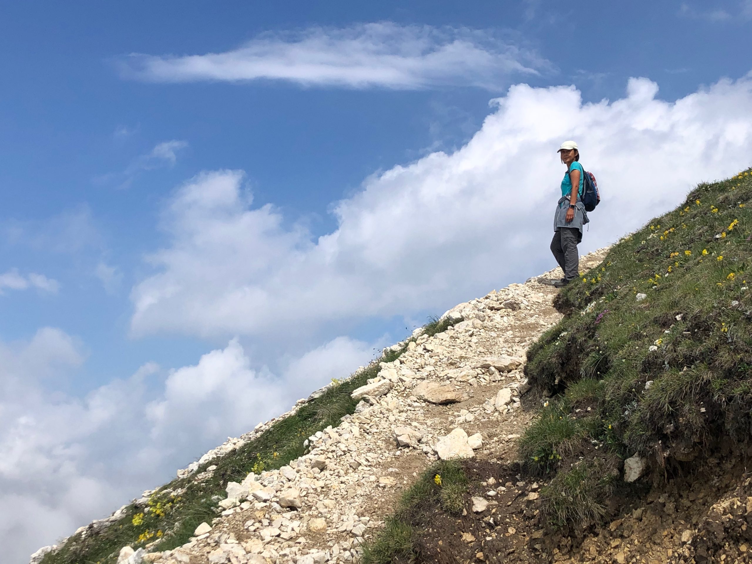
Today we twisted our way back along all the mountain roads to the starting place for the Kaiserjager Route. There was more sun than yesterday, although still a mighty load of clouds browsing on the mountains like a herd of giant sheep.
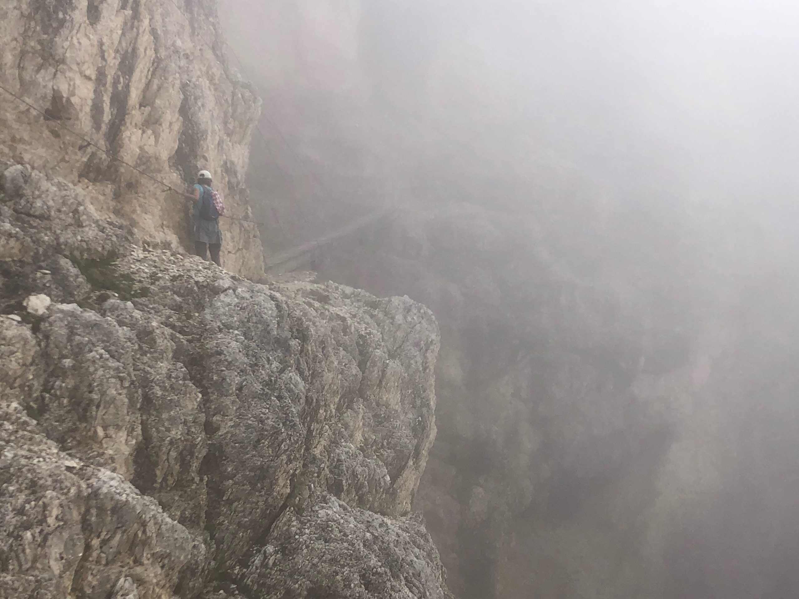
What is the Kaiserjager Route? It’s a hiking trail that was original created by Austrian/German soldiers in World War I to get up to Lagazuoi peak and has since been improved and stabilised to be safe enough for the likes of us. There are places where metal cables are pinned into the rocks so you have something to hold onto as you inch along a narrow ledge, and there’s a proper little Indiana Jones suspension bridge over a terribly long drop into a gorge.
Maureen clearly had her steam up, because we hiked past everyone else on the 300m ascent to the scary parts. Which made it more exciting because it meant my legs already felt like jelly before trying any of the narrow ledges! We also found that a lot of other hikers had come with climbing helmets and ropes to attach themselves to the metal cables. So we were either brave or stupid! I’m going with brave – it really wasn’t that dangerous, promise.
Anyway, the best bit was at the top. I find it hard to describe cresting the ridge and seeing the huge altiplano for the first time, patched with snow and surrounded by the giant peaks and crags. All I can say is that I said “WOW!” very loudly, possibly startling some nearby hikers.
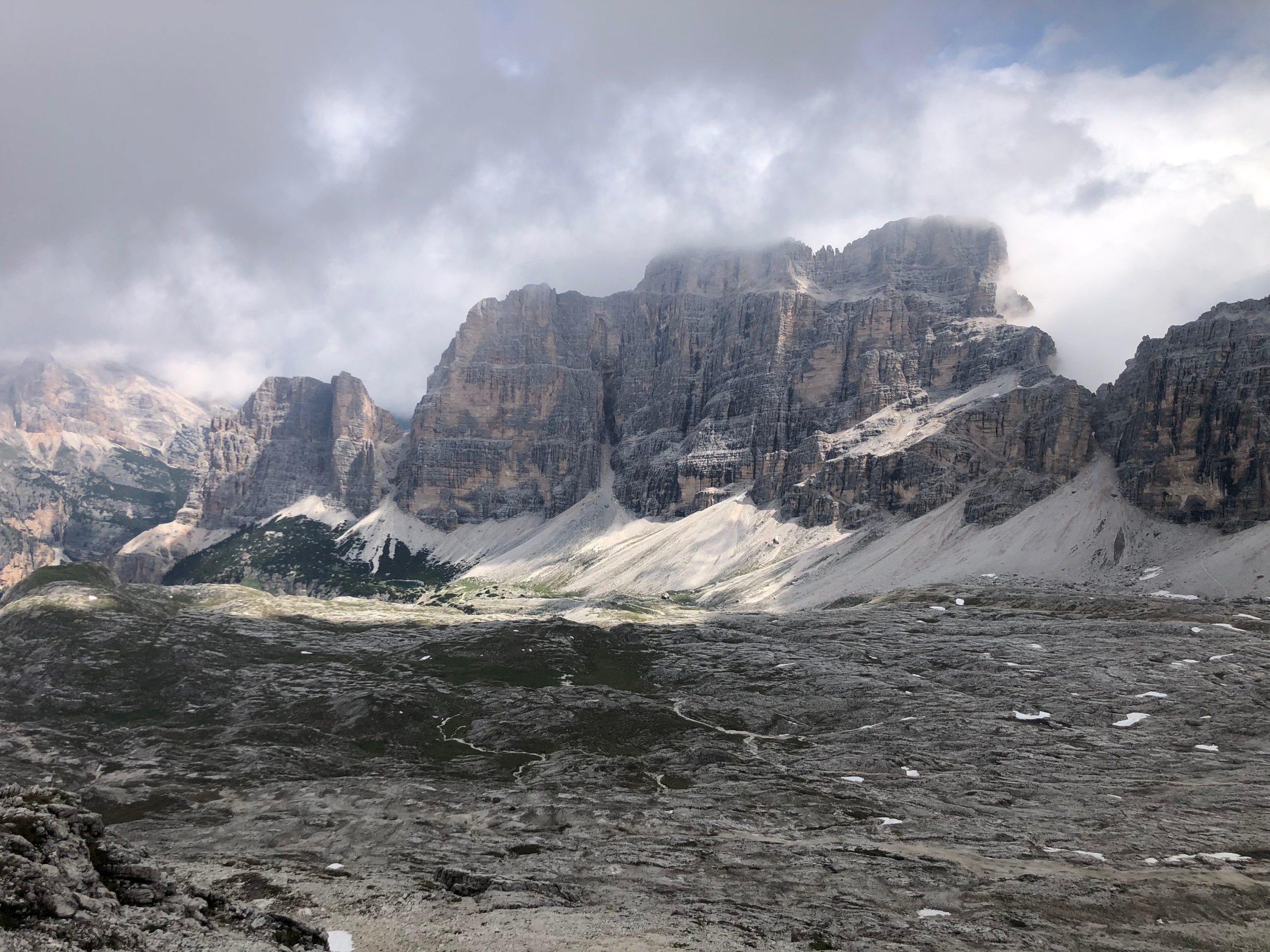
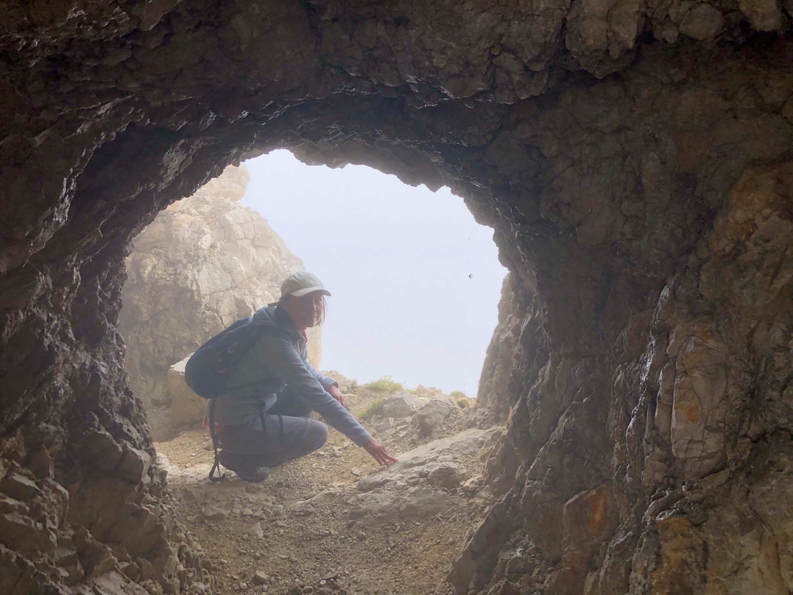
From there we had a short five minute stroll to the actual peak and the refugio right beside it, complete with wheelchair trails to the peak and dozens of people trying to find scenic photos among the clouds (there’s a cablecar up to Lagazuoi, not everyone is tough enough for the Kaiserjager route!). We enjoyed a really good bowl of goulash soup at the refugio and then explored some of the tunnels and lookout caves that the Austrian troops created up here back in 1914-18. Gazing out of a lookout at the clouds and distant slopes, it just defies belief that there were actual battles up here!
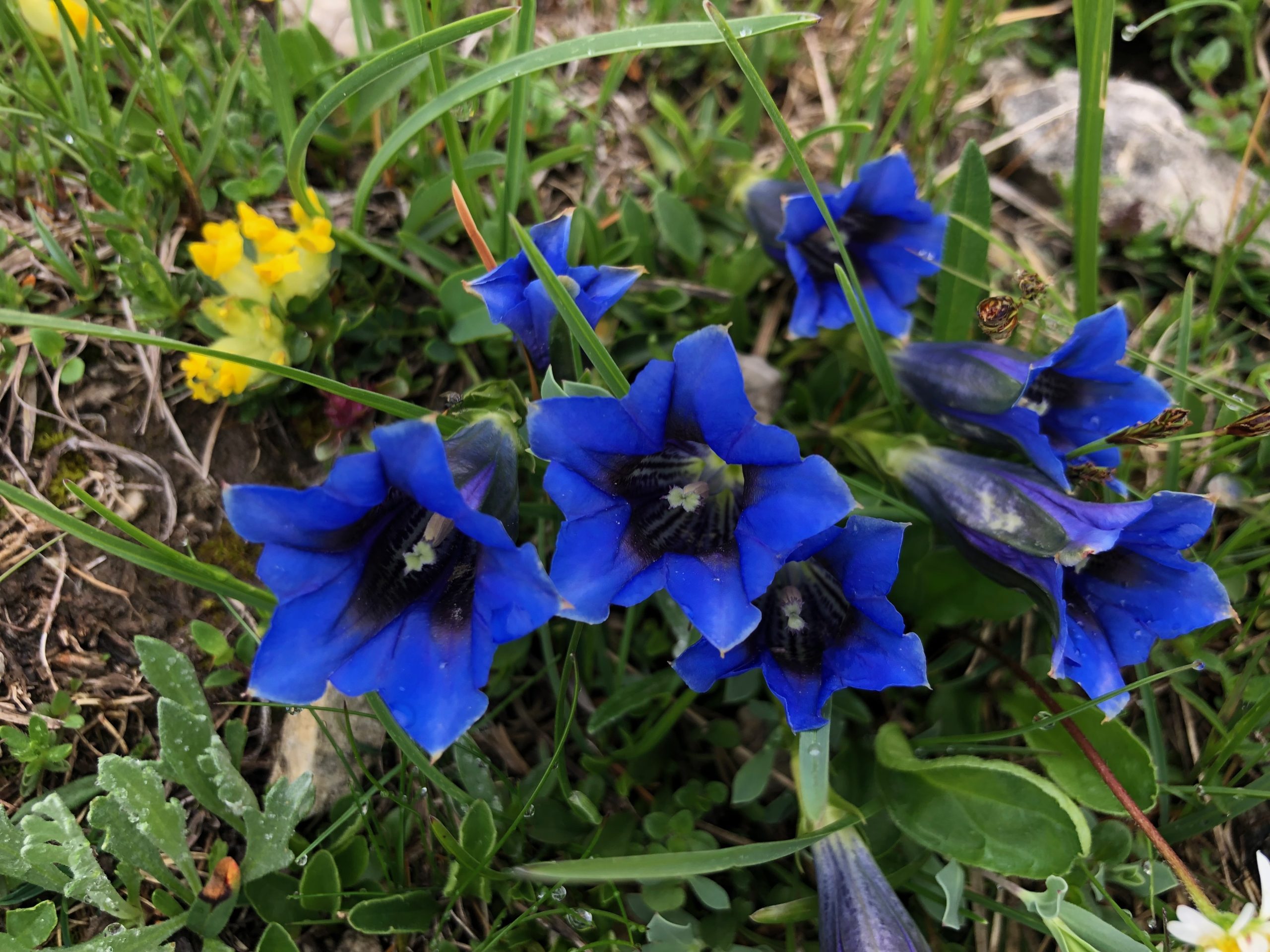
Back on the trail, there was another best bit yet to come. The second half of the hike took us down across the altiplano and back to our car via a different route, and for these two hours we saw virtually no-one. We actually had this great mountainscape to ourselves, which after yesterday we had definitely not been expecting. Oh, and I haven’t even mentioned how many flowers there were! Alpine profusions of them. And with a nice bit of luck, this time we got back to our car exactly 2 minutes before the rain came pouring down.
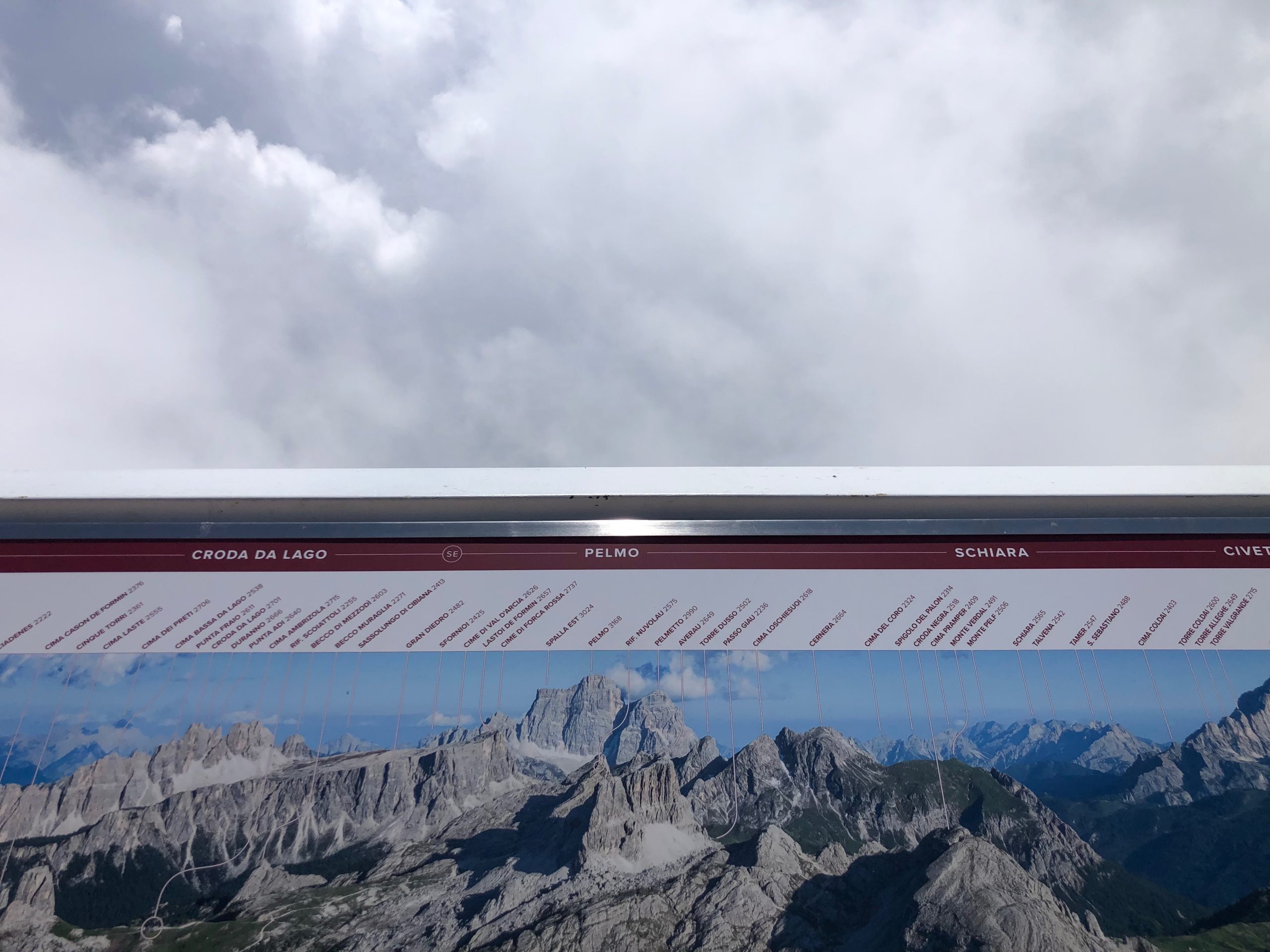
The only little blot on the day was the clouds. We may have stayed dry and had enough sun to get a bit burned (forgot the sunscreen) but the sky was still full of clouds at mountain height, which meant that the stunning panoramas from the top of Lagazuoi promised in the book and on the photo-signs on the viewing platform were entirely absent – just big walls of fluffy white all around.
Still, we got to our new accommodation happy and feeling quite proud of our ascent of the Kaiserjager Route.
Related Images: